Skip to content
ENLAPAGIS
ProductFeaturesPricingProduct tour
DESign inBook a demo
ProductFeaturesPricingProduct tourSign in to ENLAPA GISDeutsch

Loading...

ENLAPAGIS

The workspace for renewable energy project development.

A product of ENLAPA GmbH. Hosted in Frankfurt.

Product

ProductFeaturesPricingProduct tourApp login

Explore

Grid methodologyENLAPA Data APIENLAPA Netzpartnerenlapa.de

Contact & legal

Book a demoinfo@enlapa.deImprintPrivacy

ENLAPA GIS

Site check

Assess sites like your best analyst. In seconds.

Rule sets instead of gut feeling: you define the criteria for PV, storage or wind, and ENLAPA checks every Flurstück (cadastral parcel) automatically against official geodata, delivering a traceable assessment with measured values.
Book a demoRequest a quote
Back to overview
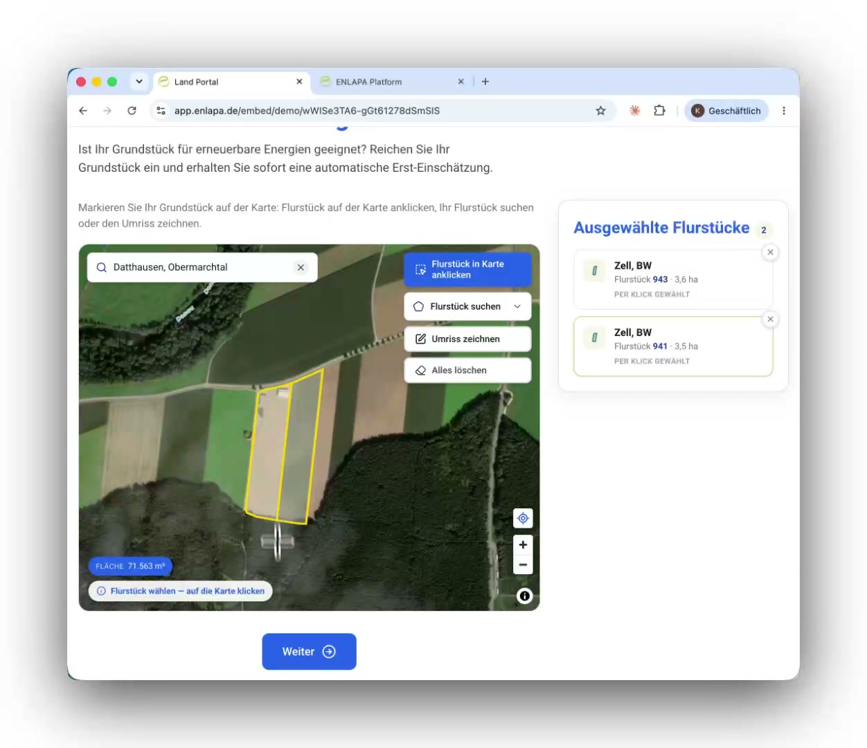
Two parcels selected by click, shown with official geometry

Selecting parcels

Three ways to a parcel.

Click on the map, draw a polygon or search: you pick whichever suits the site. More than 100 million cadastral parcels for Germany and Poland sit directly in the platform.
  • Click on the map: official geometry (DE + PL, more than 100 million parcels)
  • Draw a polygon: for partial areas and rough planning
  • Search by cadastral district, block or parcel (Gemarkung / Flur / Flurstück) or by address
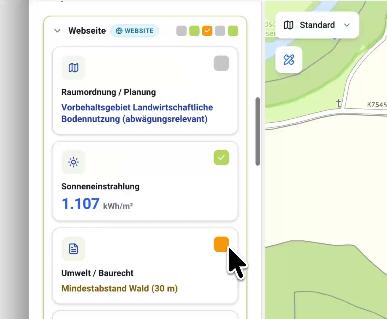
Internal assessment of a lead: categories with traffic-light status and measured values

Public vs. internal

One answer in public, the full picture internally.

Every site is checked automatically against your rule sets: you define the criteria once, the platform applies them to every submission and every search. Exactly ONE rule set drives the public website check, deliberately reduced. Internally your colleagues see the full assessment: traffic-light categories (clear / review / critical / exclusion) based on the criteria you defined yourself, per technology: a full PV check, a BESS view on grid proximity, a wind check. Change a rule and the platform re-assesses every site automatically.
  • One public rule set drives the website check, deliberately reduced
  • Internally: traffic-light categories based on the criteria you defined yourself (e.g. “substation within 1.8 km”)
  • Any number of rule sets per technology: PV, BESS, wind
  • Rule change ⇒ automatic re-assessment of every site
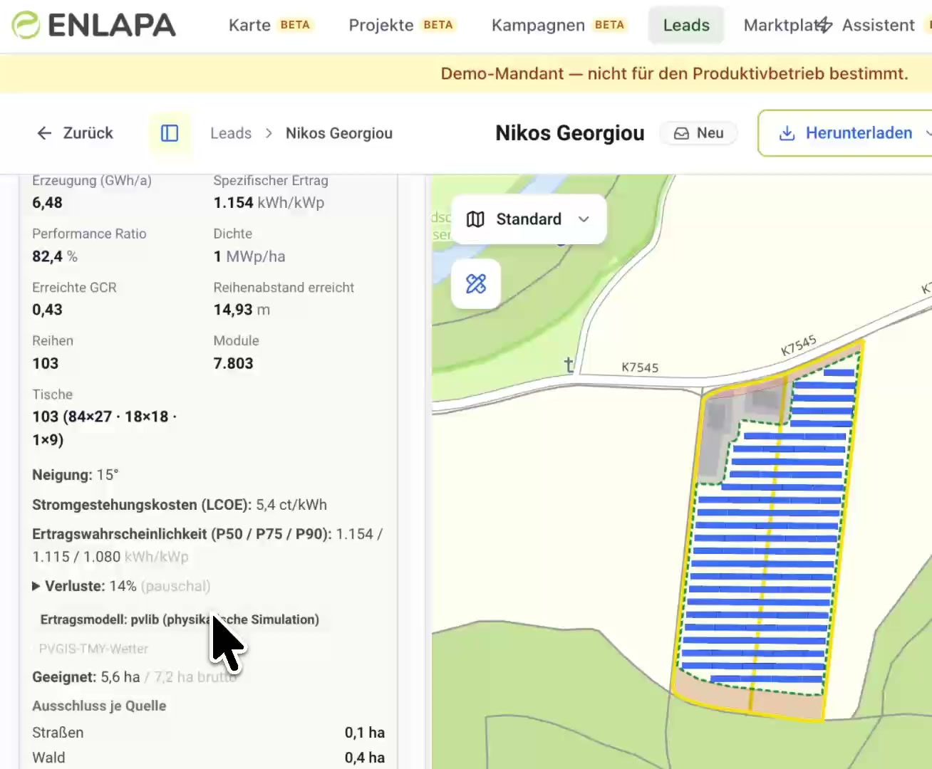
PV layout planning with key figures and module layout on the parcel

PV layout

From “suitable” to a first layout, without leaving the platform.

If the site looks promising, you plan the module layout directly on the parcel: the platform deducts setbacks from roads and forest automatically, lays out rows and tables, and runs the physical yield simulation (pvlib, PVGIS weather) with MWp, specific yield, P50/P75/P90 and levelised cost of electricity. Change tilt, row spacing or density? The result is recalculated on the spot.
  • Automatic layout with rows, tables and module count, minus exclusion areas per source
  • Yield forecast P50/P75/P90 and LCOE from a physical simulation
  • Change a parameter, get an instant recalculation, right in the lead file

Frequently asked questions

Which data sources are available for rules?
More than 300 curated sources: protected areas (BfN), Natura 2000, biotopes, water protection, regional planning, soil quality, slope, infrastructure, grid.
Can I run different checks per project type?
Yes. Rule sets can be named freely and are kept separate per technology.
What happens to older leads when rules change?
Re-assessment runs automatically; earlier results are never silently reused.

More of the platform

  • Lead capture
  • Reports and documents
  • GIS workspace
  • Grid intelligence
  • Grid intelligence methodology
  • Grid connection
  • Team and CRM
  • Vollmacht
  • AI assistant

See your next site first.

In 30 minutes we walk you through the platform using your real project regions, and afterwards you receive a quote that fits your team size.

Book a demo (30 min)Request a quote

ENLAPA GmbH · Made in Germany · Hosting in Frankfurt