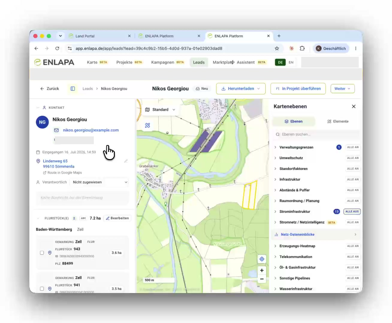
Administrative boundaries, environment and protected areas (BfN protected areas, Natura 2000, biotopes, peatlands, water protection), spatial and land-use planning (priority and reserved areas, regional plans, local development plans), site factors (soil quality, slope, aspect), infrastructure and setback distances (roads, railways, settlements), power grid (lines, substations, generation assets), your own WFS services and uploaded data. Maintained and kept current by ENLAPA, so you never source a shapefile again.
Environment and protected areas: BfN, Natura 2000, biotopes, peatlands, water protection
Spatial and land-use planning: priority and reserved areas, regional plans, local development plans
Site factors, infrastructure and setback distances, power grid
Maintained by ENLAPA, so you never source a shapefile again
Initial economics
Enough for the LOI decision.
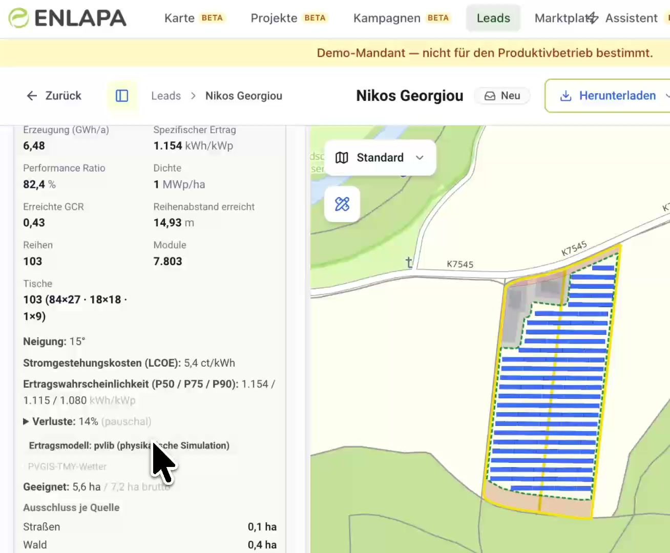
The platform lays out the PV array automatically and runs a physical yield simulation (pvlib, PVGIS weather data): MWp, specific yield, P50/P75/P90 and levelised cost of electricity, plus terrain analysis and land use. Enough to decide within minutes whether a site is worth an LOI.
Automatic PV layout with P50/P75/P90 yield forecast and LCOE
Terrain analysis: elevation, slope, aspect
Land use, the first read on the economics
Frequently asked questions
Can I bring in my own data?
Yes. Your own WFS services and file uploads appear as separate map layers, and QGIS projects can be read in.
Where does the data come from?
Official and open sources (BfN, BKG, state geoportals, OpenStreetMap, the Marktstammdatenregister (MaStR) and others), continuously updated by ENLAPA.
Do I need GIS skills?
No. Everything runs in the browser with the map interactions you already know.
See your next site first.
In 30 minutes we walk you through the platform using your real project regions, and afterwards you receive a quote that fits your team size.