Skip to content
ENLAPAGIS
ProductFeaturesPricingProduct tour
DESign inBook a demo
ProductFeaturesPricingProduct tourSign in to ENLAPA GISDeutsch

Loading...

ENLAPAGIS

The workspace for renewable energy project development.

A product of ENLAPA GmbH. Hosted in Frankfurt.

Product

ProductFeaturesPricingProduct tourApp login

Explore

Grid methodologyENLAPA Data APIENLAPA Netzpartnerenlapa.de

Contact & legal

Book a demoinfo@enlapa.deImprintPrivacy

ENLAPA GIS

Lead capture

Lead capture that understands cadastral parcels.

Landowner leads reach you through your website, at the trade fair booth and in conversation. ENLAPA turns every contact into a structured lead, with exact parcel geometry, an automatic first assessment and consent under the GDPR instead of a loose email.

Book a demoRequest a quote
Back to overview

The problem

“I might have a plot of land…” And then what?

An address by email, a screenshot from BayernAtlas, three follow-up questions until it is clear which Flurstück (cadastral parcel) was meant. At ten enquiries a week that adds up to half a working day of data entry, before the actual assessment has even started.
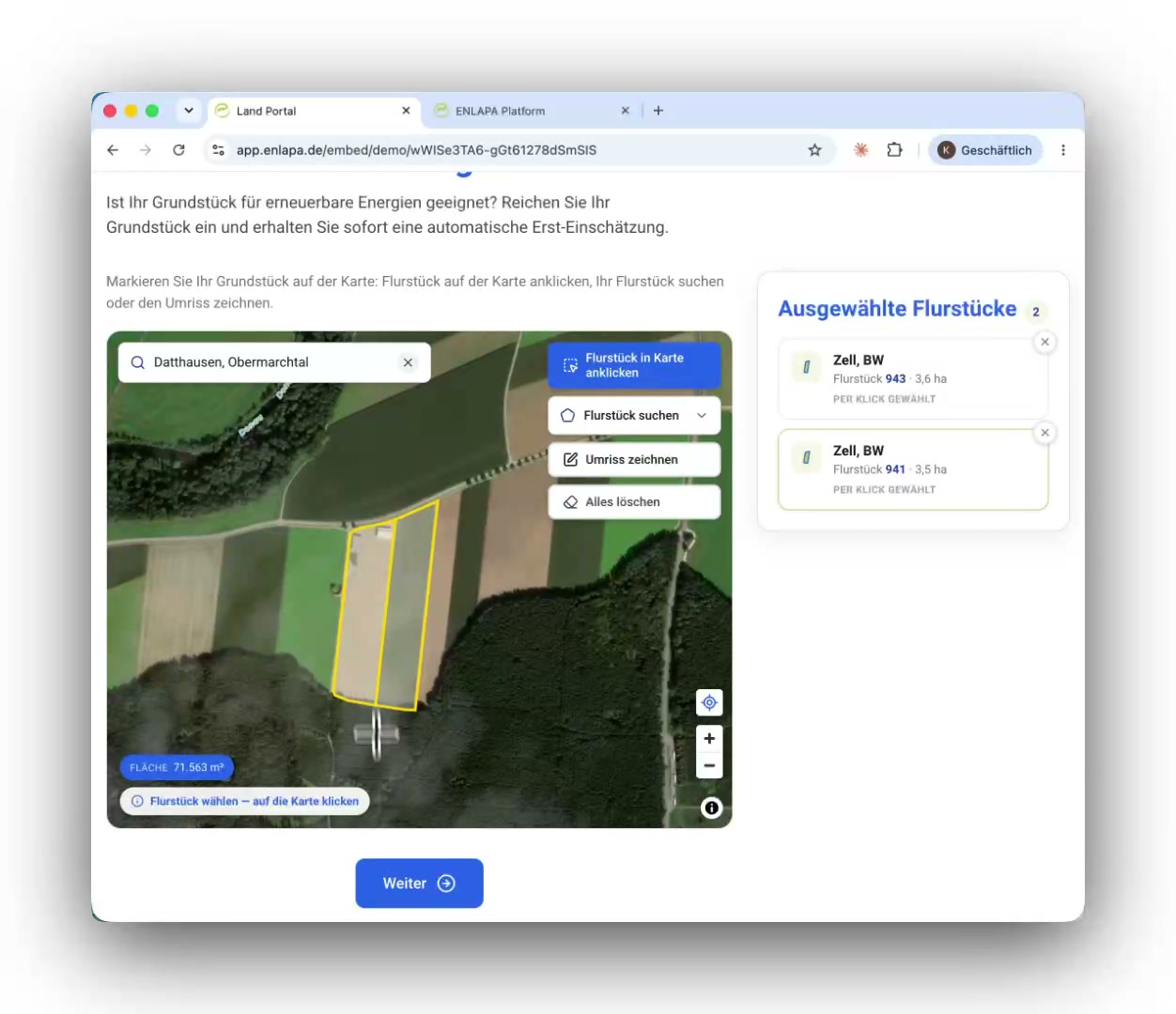
Two parcels selected by click with official geometry in the public site check
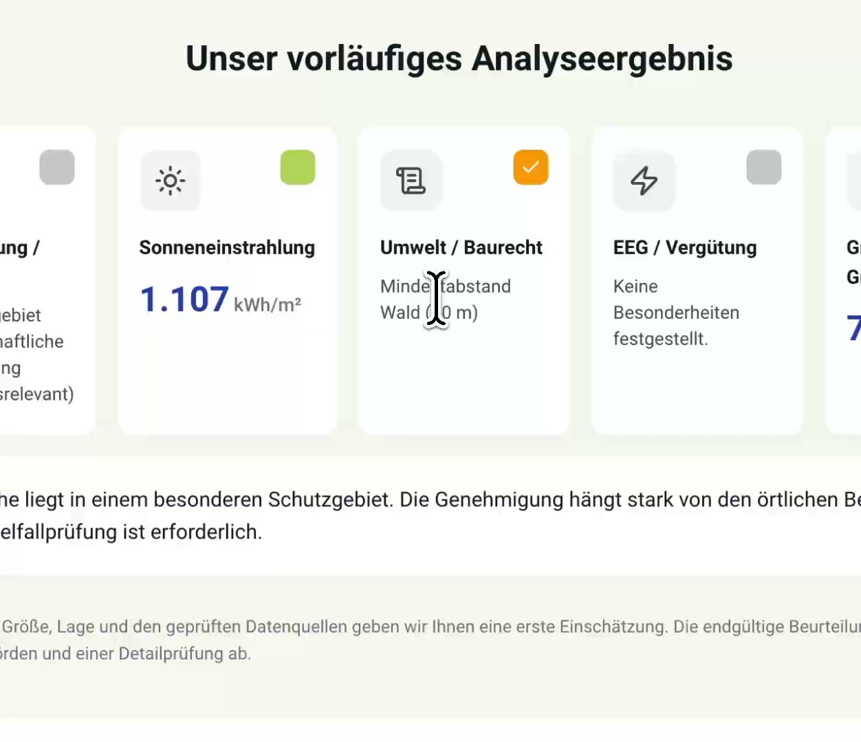
Colour-coded instant result of the public site check

On your website

The landowner sees their result before they even leave contact details.

The landowner opens the site check on your website, searches for their address and clicks their plot on the map: the official parcel boundary snaps into place. In the same moment the platform assesses the site fully automatically against your criteria and shows a colour-coded result: solar irradiation, environment and planning law, EEG (renewable energy act) tariff, grid connection, site size. Anyone who then leaves contact details together with consent is no longer a cold contact, but a landowner who knows the result and wants to know more. Up to this point your team has not lifted a finger, and it receives a lead that is ready for qualification.
  • Official parcel boundary snaps in on click (DE + PL)
  • Assessment runs fully automatically, with the result before first contact
  • Lead with geometry, area, cadastral district, assessment and grid operator
HTML
<div id="enlapa-flaechencheck"></div>
<script src="https://app.enlapa.de/embed.js"
        data-tenant="your-company"
        data-locale="en" async></script>

Integration in minutes
One copy-paste snippet is enough.

A <div> placeholder plus one script line, generated in your branding settings. The widget builds itself, adjusts its height to the content automatically and is hardened against caching and optimiser plugins (WP Rocket, Autoptimize and the like), so it runs in WordPress, Typo3, Wix, Webflow and any other CMS. Your website domain is cleared in advance via an allowlist. Alternatively you link to the hosted portal, on request under your own domain (flaechencheck.your-company.de).
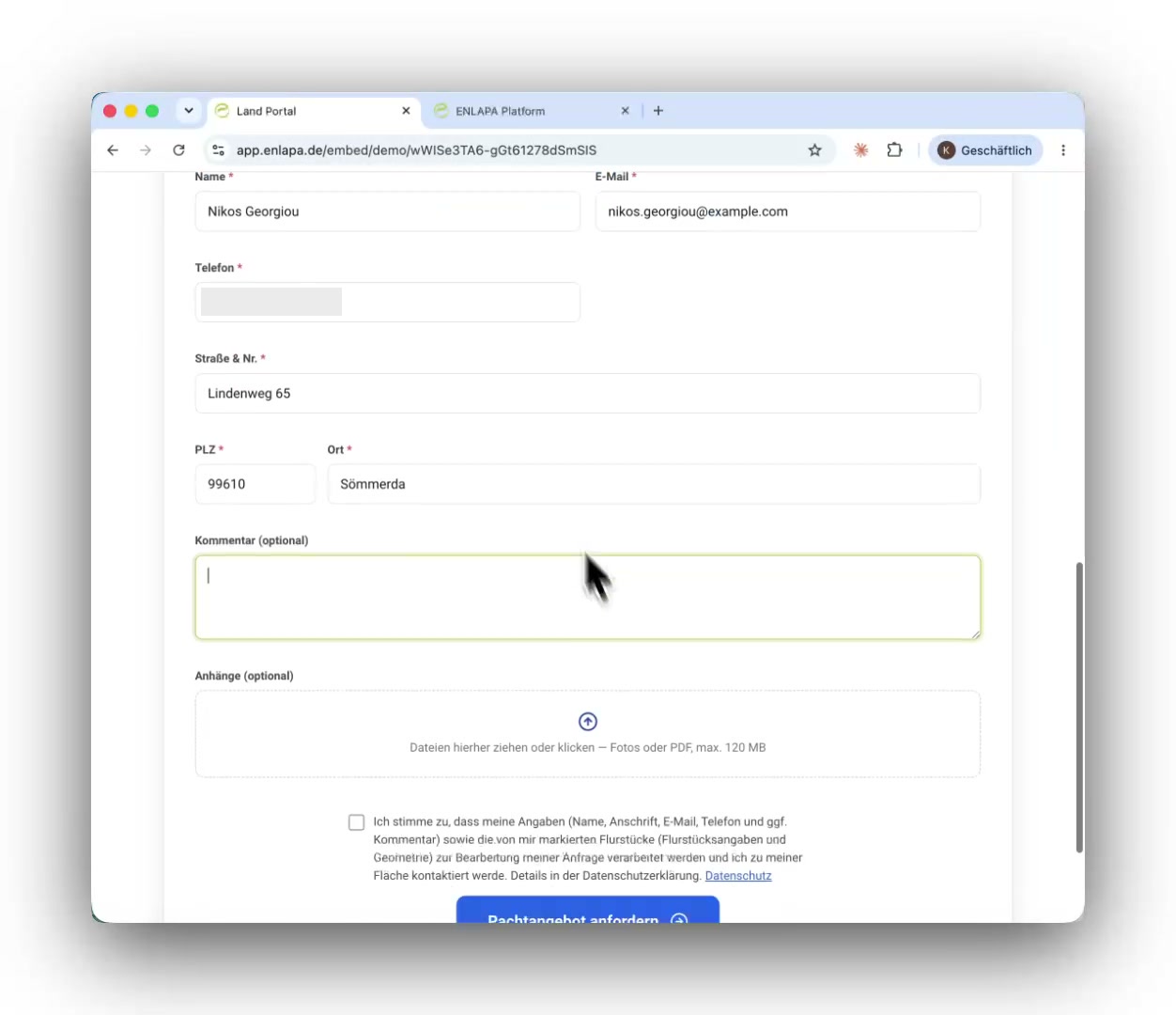
Completed contact form of the public site check including consent

On site

At the trade fair booth and in meetings.

The same check runs on a tablet: talk at the booth, turn the map, click the plot, show the result. Contact details and consent are captured within a minute. A conversation at the booth becomes a documented lead before the visitor moves on.
  • Instant first assessment as a conversation opener at the booth
  • Contact details, phone number and GDPR consent directly in the form
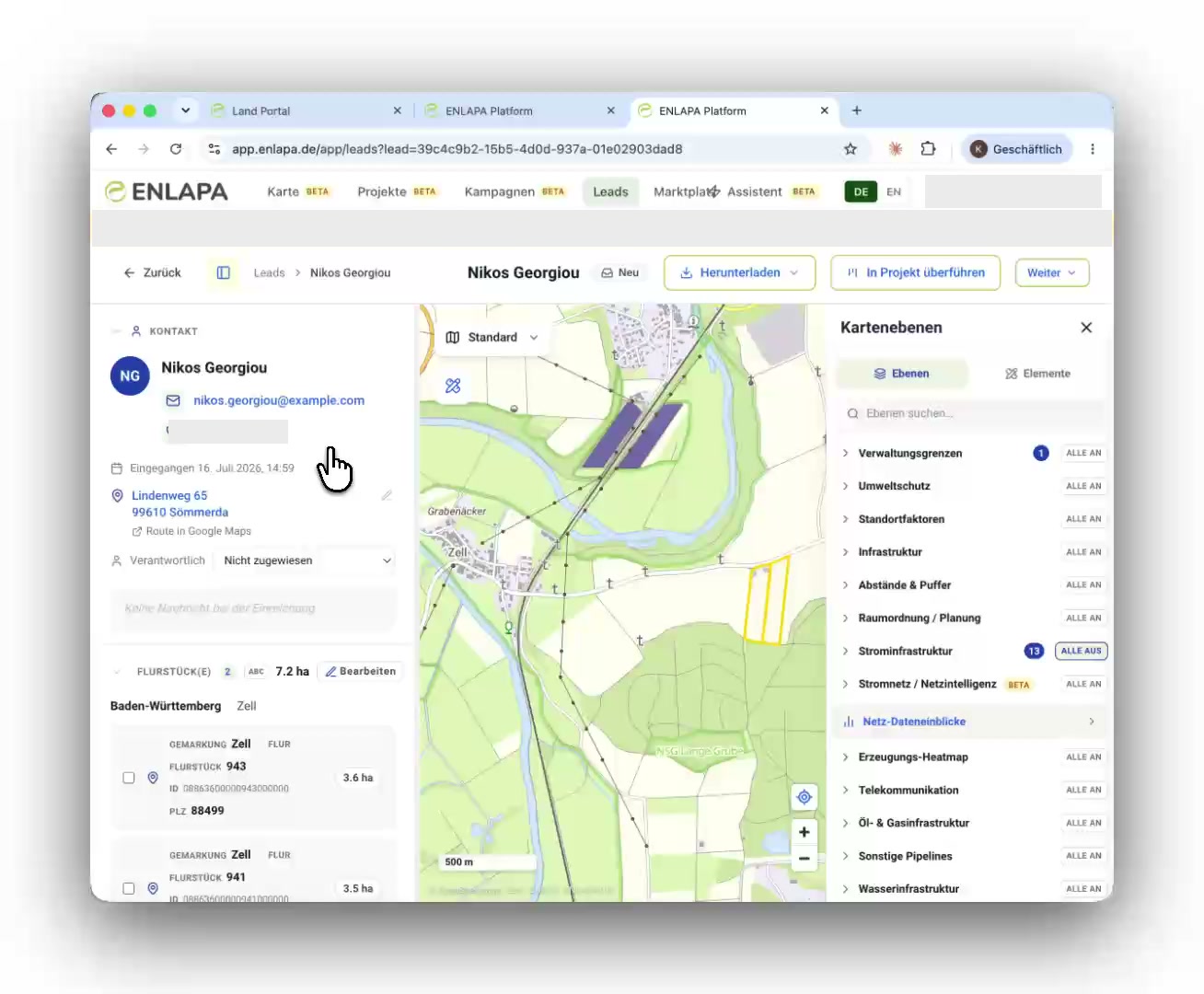
Lead file in the inbox: contact, parcels and map

In your inbox

The finished lead file, without your team lifting a finger.

Every submission appears immediately as a complete file: parcels with geometry, site size, first assessment and the responsible grid operator, plus the parcel map and the site analysis as automatically generated PDFs. The platform produced all of it without human input; your team starts straight at qualification. On request ENLAPA notifies you by email, Slack or webhook into your CRM.
  • Parcel or parcels with geometry, area and cadastral district, captured automatically
  • First assessment and grid operator lookup, determined automatically
  • Parcel map and site analysis as PDF, generated automatically, ready to share
  • Notification by email, Slack or webhook to your CRM

Frequently asked questions

Does the widget work in WordPress?
Yes, one script line in an HTML block is enough; the iframe adjusts its height automatically. Your website domain is cleared in the platform beforehand.
Does the landowner see the complete assessment result?
No. The public rule set is yours to define, and it decides what is visible externally; the full assessment stays with you.
What about data protection?
Consent is captured explicitly and stored; contact details leave the platform only through integrations that you activate, and only with consent. Hosting in Frankfurt.
Can several parcels be submitted at once?
Yes, the landowner can select several parcels and submit them together.

More of the platform

  • Parcels and site check
  • Reports and documents
  • GIS workspace
  • Grid intelligence
  • Grid intelligence methodology
  • Grid connection
  • Team and CRM
  • Vollmacht
  • AI assistant

See your next site first.

In 30 minutes we walk you through the platform using your real project regions, and afterwards you receive a quote that fits your team size.

Book a demo (30 min)Request a quote

ENLAPA GmbH · Made in Germany · Hosting in Frankfurt